Digital photo documentation
Foto-GIS digitizes all of your photo documentation needs. Our system uses APP, SAFE, and ORGANIZER in order to create more efficiency, safety and quality through automation.
In accordance with guidelines and requirements of national broadband expansion.

RECORD · DEPOSIT · RECALL · ALL DIGITAL
FOTO-GIS: Modern digital possibilities for all your professional photo documentation needs
Editing and storing digital images can be time and resource-consuming. Foto-GIS simplifies this process and can handle a large number of digital images, providing each image with valuable attributes to be saved on a project-specific basis. Foto-GIS utilizes a completely digital process, from photo creation all the way to storage and processing. This means more quality, data security, and less time wasted in the field.
Foto-GIS simplifies this process and can handle a large number of digital images, providing each image with valuable attributes to be saved on a project-specific basis.
Foto-GIS utilizes a completely digital process, from photo creation all the way to storage and processing. This means more quality, data security, and less time wasted in the field.
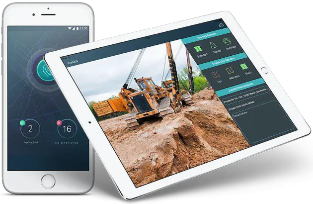
RECORDING WITH THE APP
The data acquisition, i.e. the image capturing, is done via the Foto-GIS APP. This free APP can be installed on any mobile device (iOS/Android).
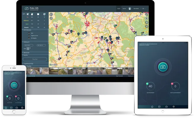
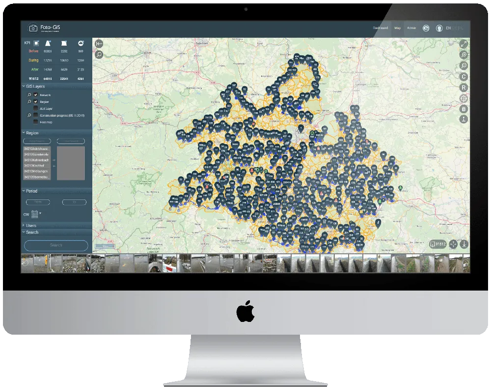
ORGANIZER
In the overview you can set up projects, monitor progress, and benefit from the output options, all with the help of GIS maps.
No more photo chaos!
Get photo GIS for recording, storing and recalling geocoded image data. With the efficient system trio you save time and money. Because now tidiness is guaranteed.
Your advantages at a glance
Efficiency
Reduced staffing, less time consumption, less costs through digitalized processes.
Simplicity
Intuitive operation of the APP and automatic assignment of photo attributes.
Quality
Storage of the photos in highest resolution for documentation of the smallest details.
Speed
Immediate access to transferred data enables working in real time.
Overview
Planning, coordination and controlling of many construction projects at same time.
Independence of location
Remote acceptance of construction measures without costly on-site appointments.
Transparency
Possible access also for contracting authorities through adapted user roles.
Security
Encrypted data - SAFE in a U.S. cloud with the highest security standards.
Technology
Powerful servers for large amounts of data and backup of your data.
Customisation
Interface adaptation to existing project management software is possible.
Scalability
One user or a thousand - we grow with you. The system trio works in every size.
Future security
Your data remains unlimited (during the contract period) available
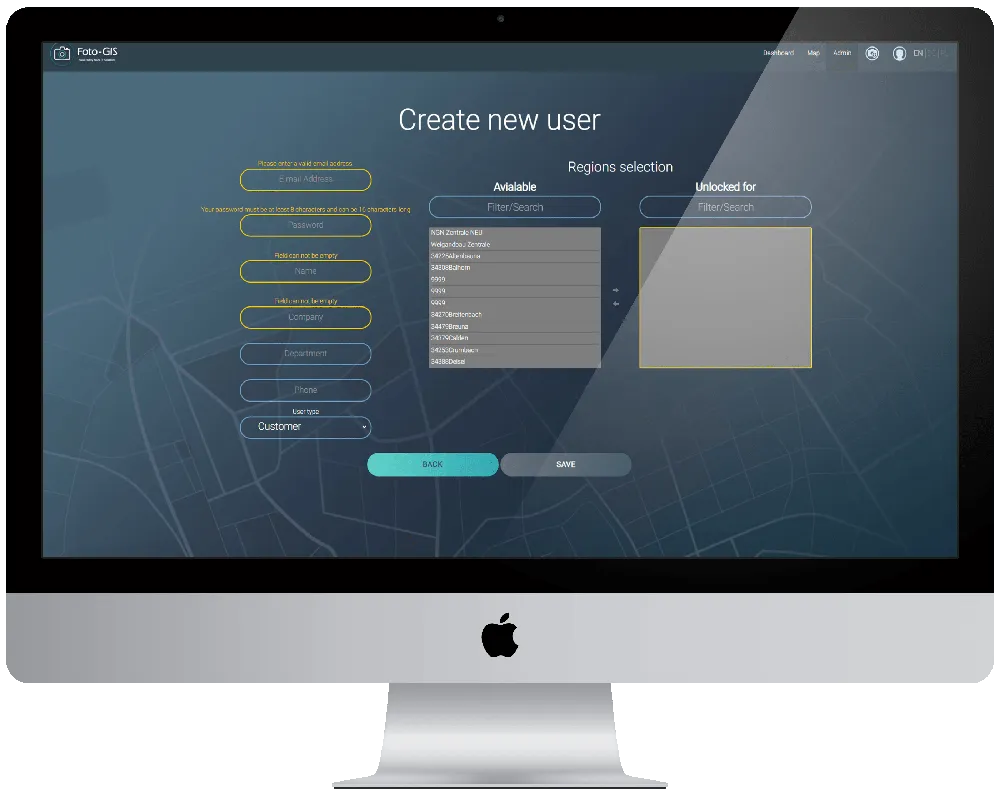
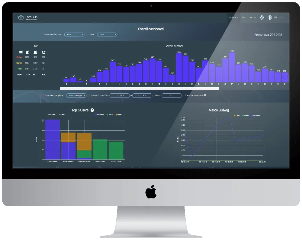
The ORGANIZER creates order
Sort your photos into an infinite number of projects, assign attributes that are important to you and find your images again easily. Anytime.
We advise and train you so that you can use Foto-GIS exactly the way you need it.

Dates for the free basic online training course
Get to know the basic functions, quickly achieve your first results and practise using the APP and ORGANIZER with our online trainer.
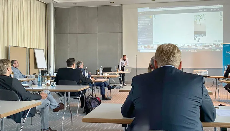
Booking of an optional one-day training on site for more in-depth knowledge
This is about the full power of the system trio: special APP functions, individual settings for the ORGANIZER and tips to make your work even more efficient.
Download the document you are interested in.
What our customers say about Foto-GIS
„Foto-GIS turned out to be a daily indispensable tool for the the realization of of large-scale expansion projects.“
TKI Tele-Kabel- Ingenieursgesellschaft, Chemnitz
„With the usability itself, the support and also the sales contact we are extremely satisfied. So far, the whole thing has not let us down once and has successfully managed and documented several thousand photos centrally.“
STF Gruppe GmbH
„The largest public FTTC expansion project in in Europe with more than 200,000 project photos of over 2,000 km of routes and about 1,500 locations could be documented and completed thanks to FOTO-GIS.“
Weigand Bau GmbH, Bad Königshofen
„The software fully meets our expectations as it is easy to use for people working in the field, and at the same time it is sufficiently developed for those supervising the work from the office. Thanks to the possibility of selective sharing of materials, the system is also used by our investors. In our case it is particularly valuable to have an orderly photo-documentation for the realization of the investment.“
Meliorex sp. z o.o.
„The Foto-GIS system is the right solution for Fibersolutions sp. z o.o. It provides up-to-date knowledge of the key tasks performed by the company and optimizes the activities of our employees. As an integrated IT system it is worth recommending to potential buyers. We conducted the implementation in April of 2020. NGN IT Solutions has demonstrated professionalism and high standards of operation, which fully justifies recommending it as a Company providing service at the highest level.“
Fibersolutions sp. z o.o.
„Implementation of the system was preceded by a test period of several weeks, combined with training of our employees. At present, the Foto-GIS application is actively used by 80 users in our company. Thanks to the purchase of the software we have reduced the time our site managers had to work on creating orderly as-built documentation. In the opinion of our employees, using the software is simple and intuitive. The service provider successively introduces changes and improvements to the Foto-GIS system which are very helpful for us.“
Fonbud sp. z o.o.
„For us, the advantages of the app are primarily in the monitoring of large construction sites, which allows us to provide the client with quick and precise evidence and information at any time (also on site via the mobile app). We are enthusiastic about the concept and have experienced professional support since the beginning of use.“
Erdkraft Tief- und Hochbau GmbH
„In the course of the projects carried out, the company NGN IT Solutions proved to be a solution-oriented partner even in difficult issues. The work was carried out at a high technical level, in compliance with the set requirements, to our complete satisfaction.“
GEO DATA GmbH
„Implementation of the software has been very smooth and has removed the need for additional investments in hardware. After a short test period it became clear for us that this is the perfect solution to monitor our works on the railroads.“
Erista sp. z o.o.
„Foto-GIS turned out to be a daily indispensable tool for the the realization of of large-scale expansion projects.“
TKI Tele-Kabel- Ingenieursgesellschaft, Chemnitz
„With the usability itself, the support and also the sales contact we are extremely satisfied. So far, the whole thing has not let us down once and has successfully managed and documented several thousand photos centrally.“
STF Gruppe GmbH
„The largest public FTTC expansion project in in Europe with more than 200,000 project photos of over 2,000 km of routes and about 1,500 locations could be documented and completed thanks to FOTO-GIS.“
Weigand Bau GmbH, Bad Königshofen
„The software fully meets our expectations as it is easy to use for people working in the field, and at the same time it is sufficiently developed for those supervising the work from the office. Thanks to the possibility of selective sharing of materials, the system is also used by our investors. In our case it is particularly valuable to have an orderly photo-documentation for the realization of the investment.“
Meliorex sp. z o.o.
More customers


Because we love what we do
NGN IT-Solutions GmbH is a young ITC consulting and software development company with close relations to various software development centres in Poland. We have many years of experience in ITC project management and management consultancy. In addition to various companies in the ITC sector, we also advise and and support municipal development projects.

Foto-GIS comes from practical experience. A few years ago, we took over a photo documentation project for a large municipal building. At the time, there wasn’t a suitable tool that worked for what we needed. So, we developed our own.
Gunnar Gröschl, CEO of the NGN IT Solutions GmbHYour contact person:
Derek Bogdan
derek.bogdan@foto-gis.com
Phone: +1 847-675-5767
Office hours: 8:00 a.m. to 4:00 p.m.